TerraHealth
Powering a Global Decision Engine for Climate-Sensitive Disease Forecasting
TerraHealth
Powering a Global Decision Engine for Climate-Sensitive Disease Forecasting
Planetary Health Informatics — AI for People and Planet
ABOUT.
Building a Planetary Immune System
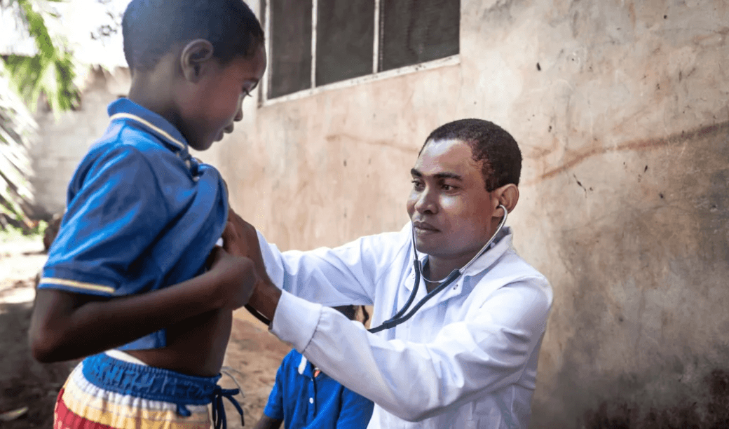
TerraHealth is a climate-health AI platform that learns a shared spatiotemporal representation from multiple geospatial and predictive models, enabling the generation of task-specific disease forecasting models. Rather than training a single model from data, TerraHealth integrates knowledge across EO and health models to improve generalisation across regions and diseases. This framework combines multi-modal EO data, EHR records, and federated analytics to deliver scalable, anticipatory decision support for infectious and selected non-communicable diseases.
Three Pillars of Planetary Intelligence
Personalised Health
Individual-level modelling and precision intervention

Population Health
Scalable analytics for communities and systems

Planetary Health
Integrated Earth–human system intelligence
Personalised Health
Individual-level modelling and precision intervention
Population Health
Scalable analytics for communities and systems
Planetary Health
Integrated Earth–human system intelligence
PROJECTS.
Explore our
PHI Oxford
research projects
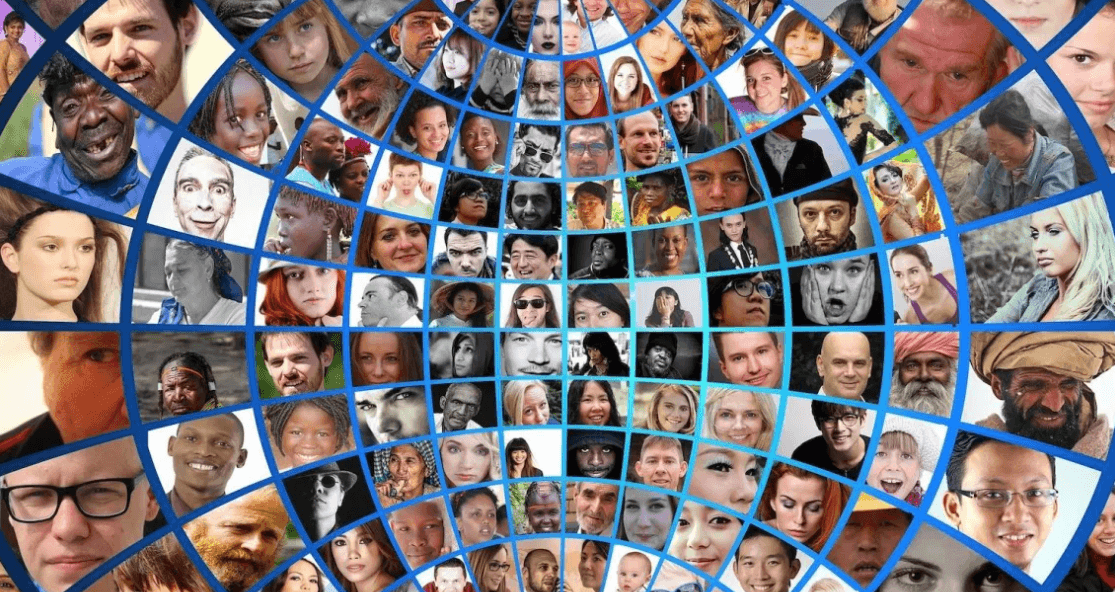
- AI fairness across demographics
- Clinical NLP for low-resource settings
- Women's health & menstrual equity
- Climate change & human health
- Digital Public Infrastructure
PHI Lab
University of Oxford

Ethnicity, Health Equity & AI

Fair & Safe Medical AI

Menstrual Health in Low-Resource Settings
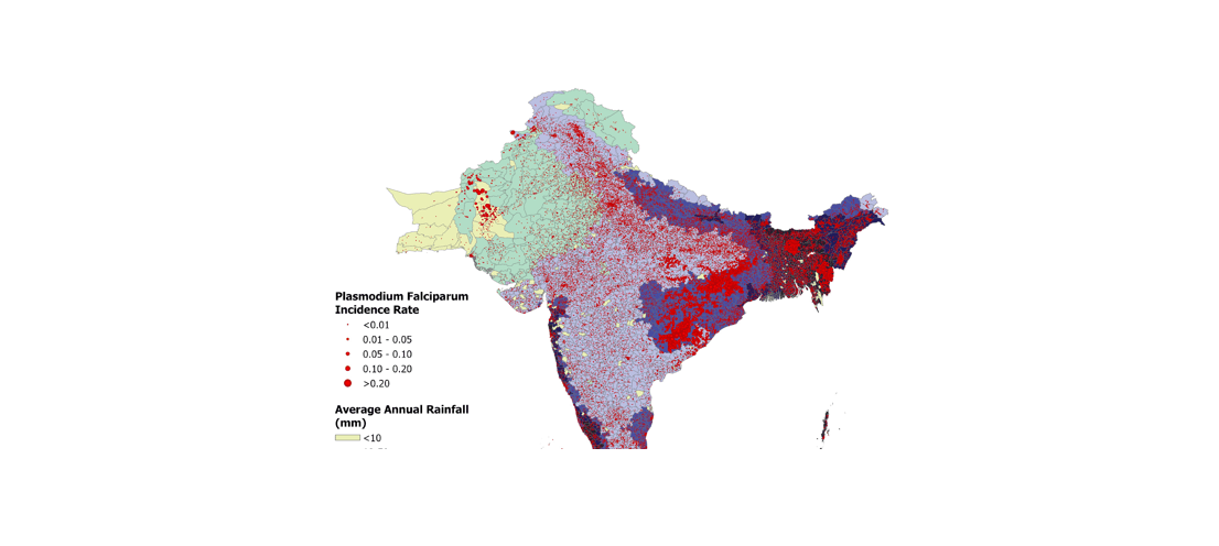
Predicting Malaria Outbreaks
West Africa Climate & Health Consortium

LLM Clinical Note Processing
Debiasing Healthcare AI

Emissions Sources Detection
Global AI Health Equity Hub
An open collaborative platform for sharing debiasing tools, fairness benchmarks, and validated AI models across health systems in LMICs — a global commons for equitable health AI.
TOOLS.
Browse our catalogue of available tools — built by the Planetary Health Informatics Lab to turn data into decisions.
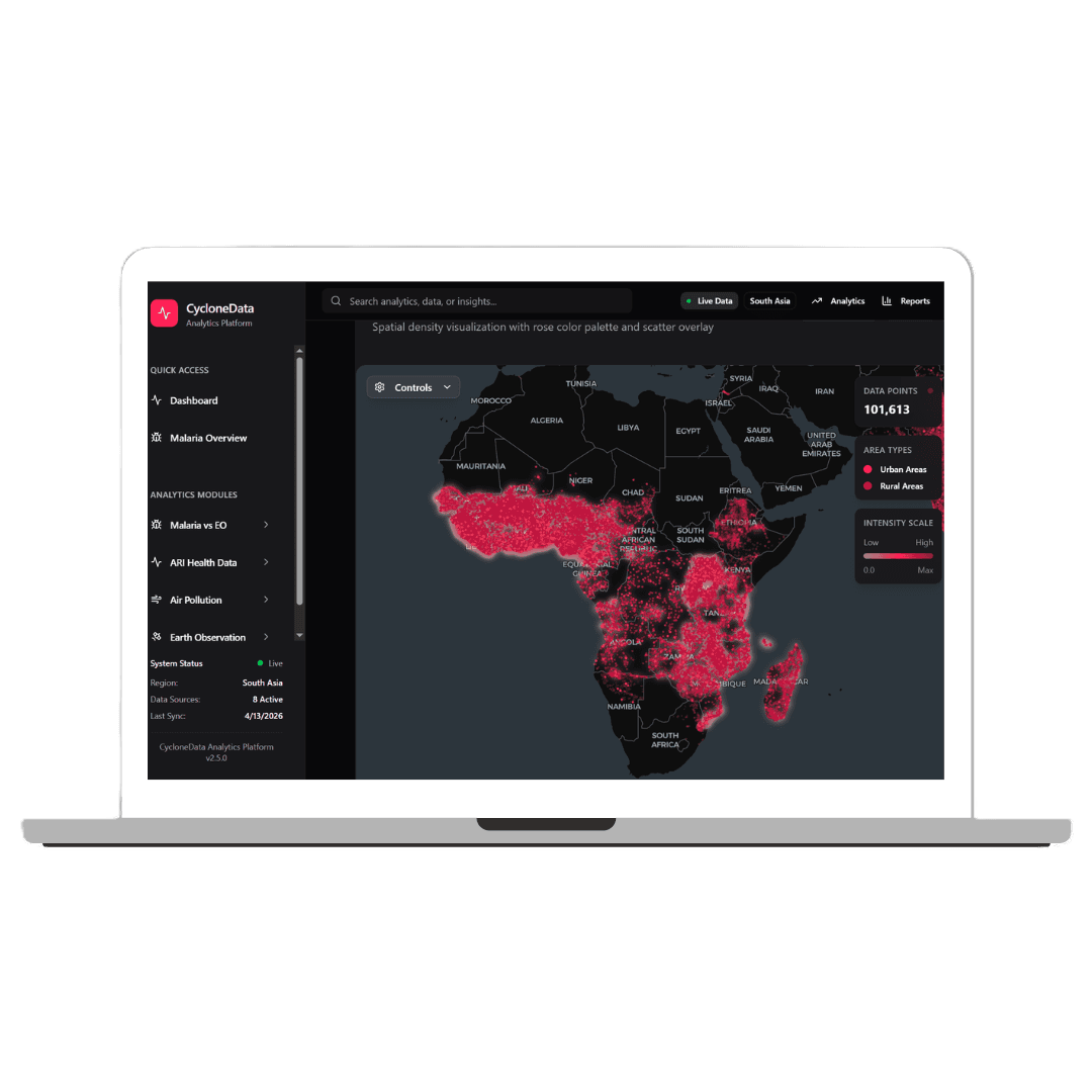
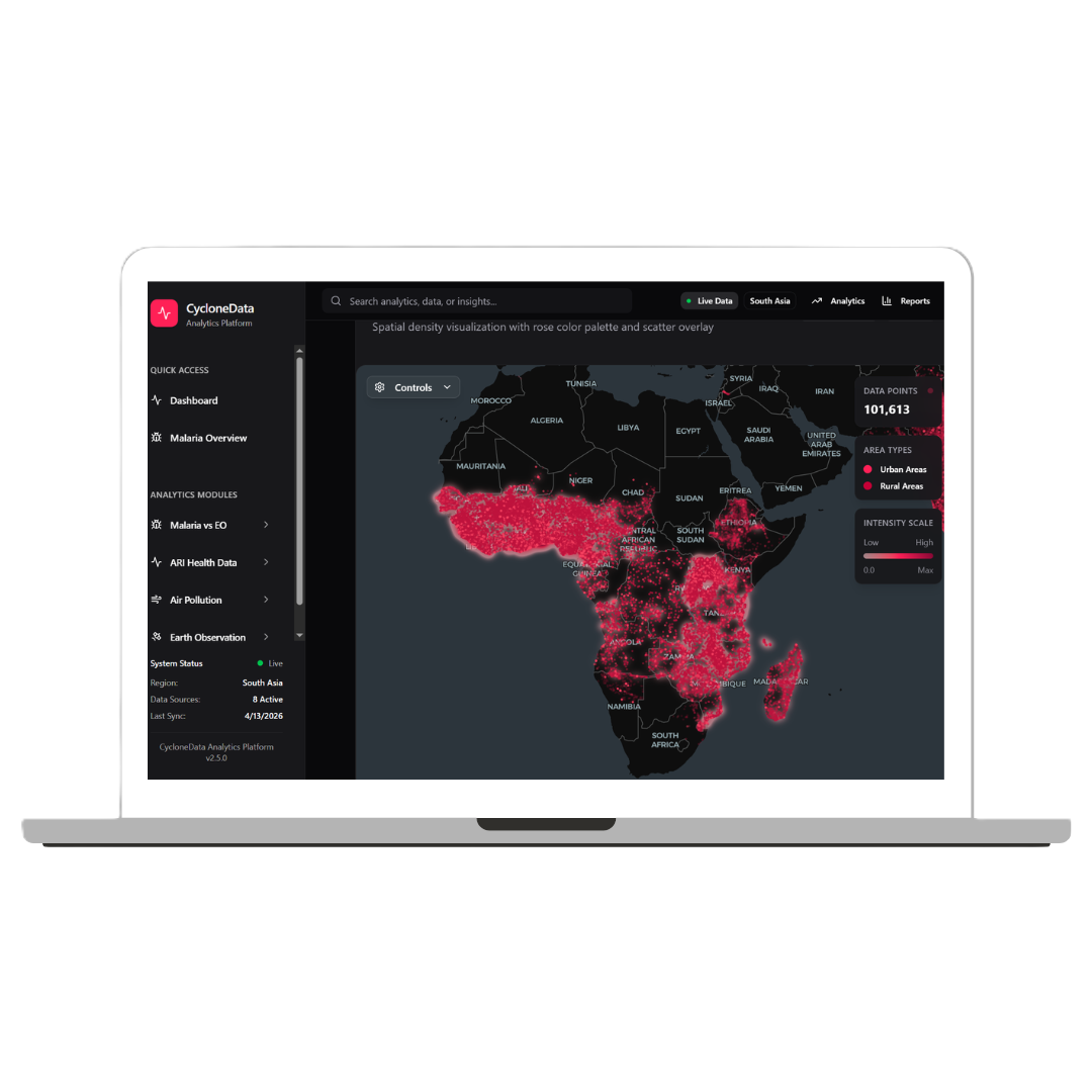
Cyclone
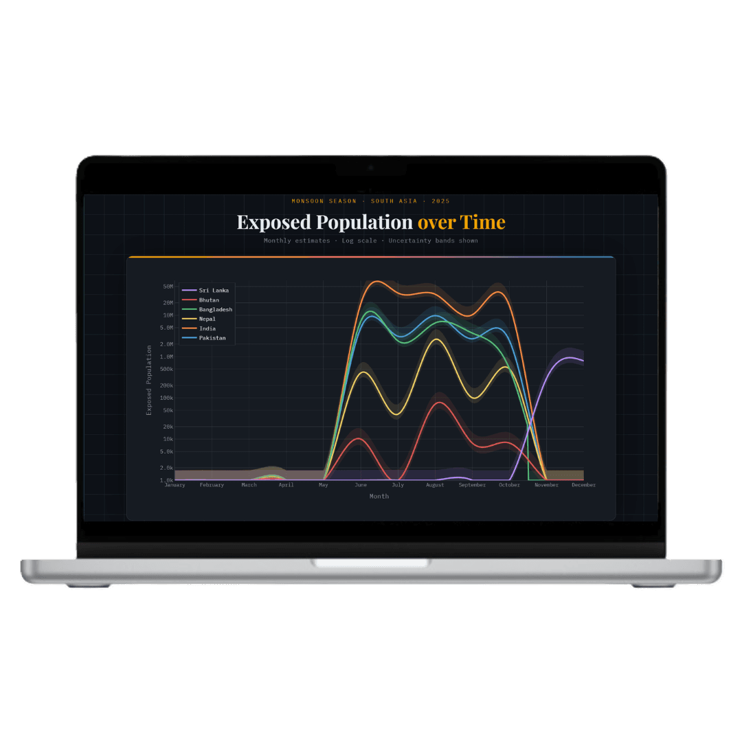
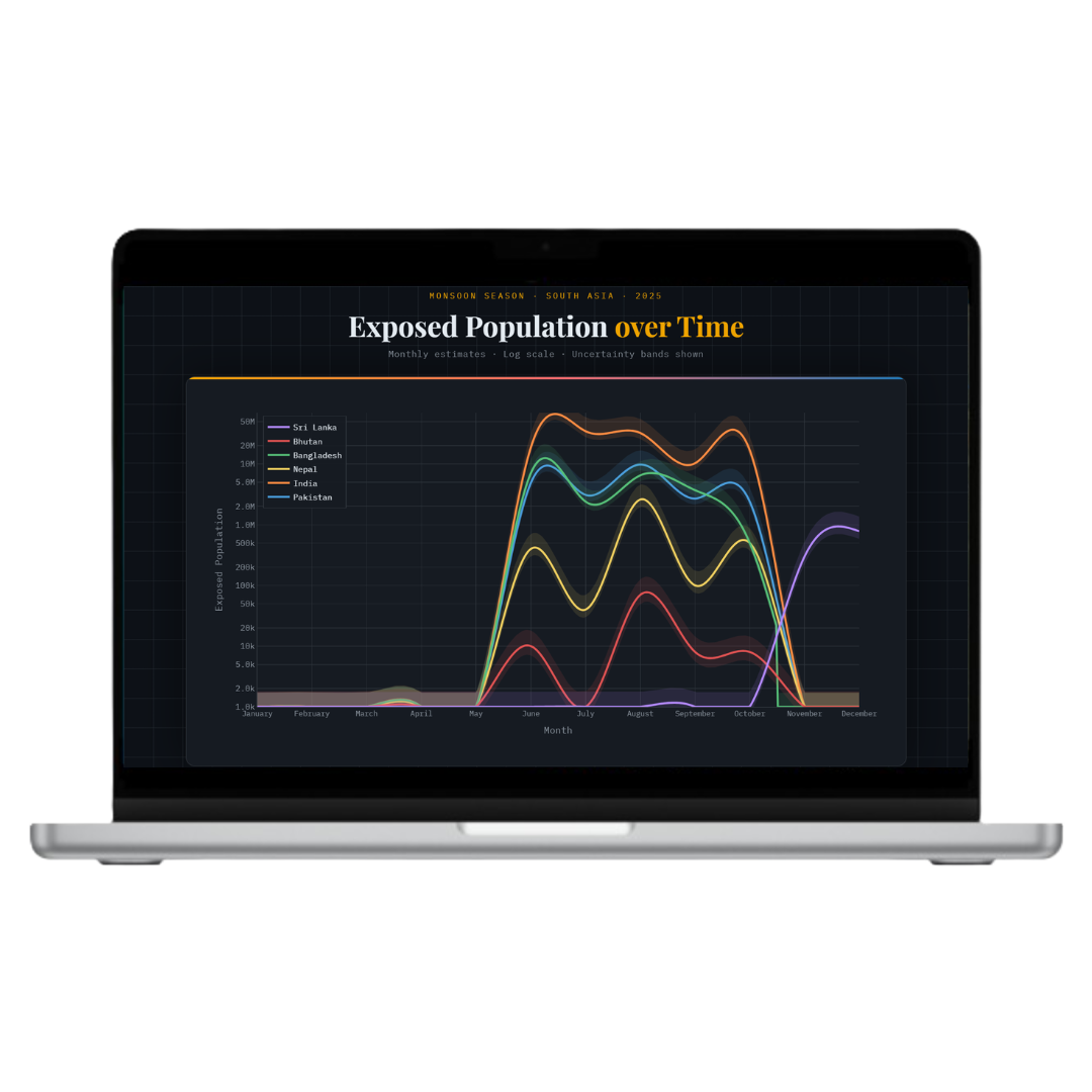
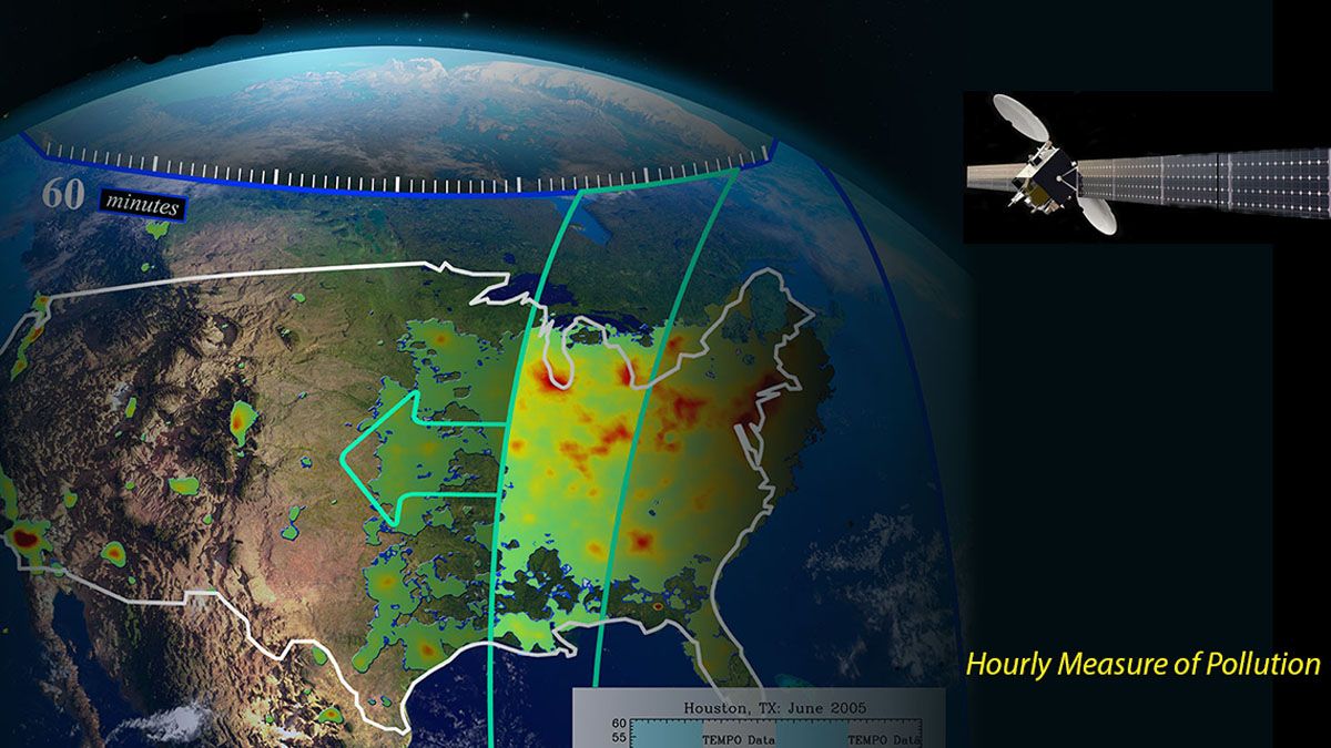
Analysing cyclone patterns, intensity trends, and population health impacts to support climate-sensitive disease forecasting and early warning systems.
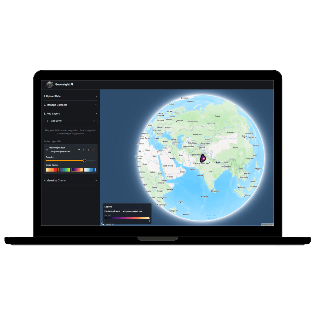
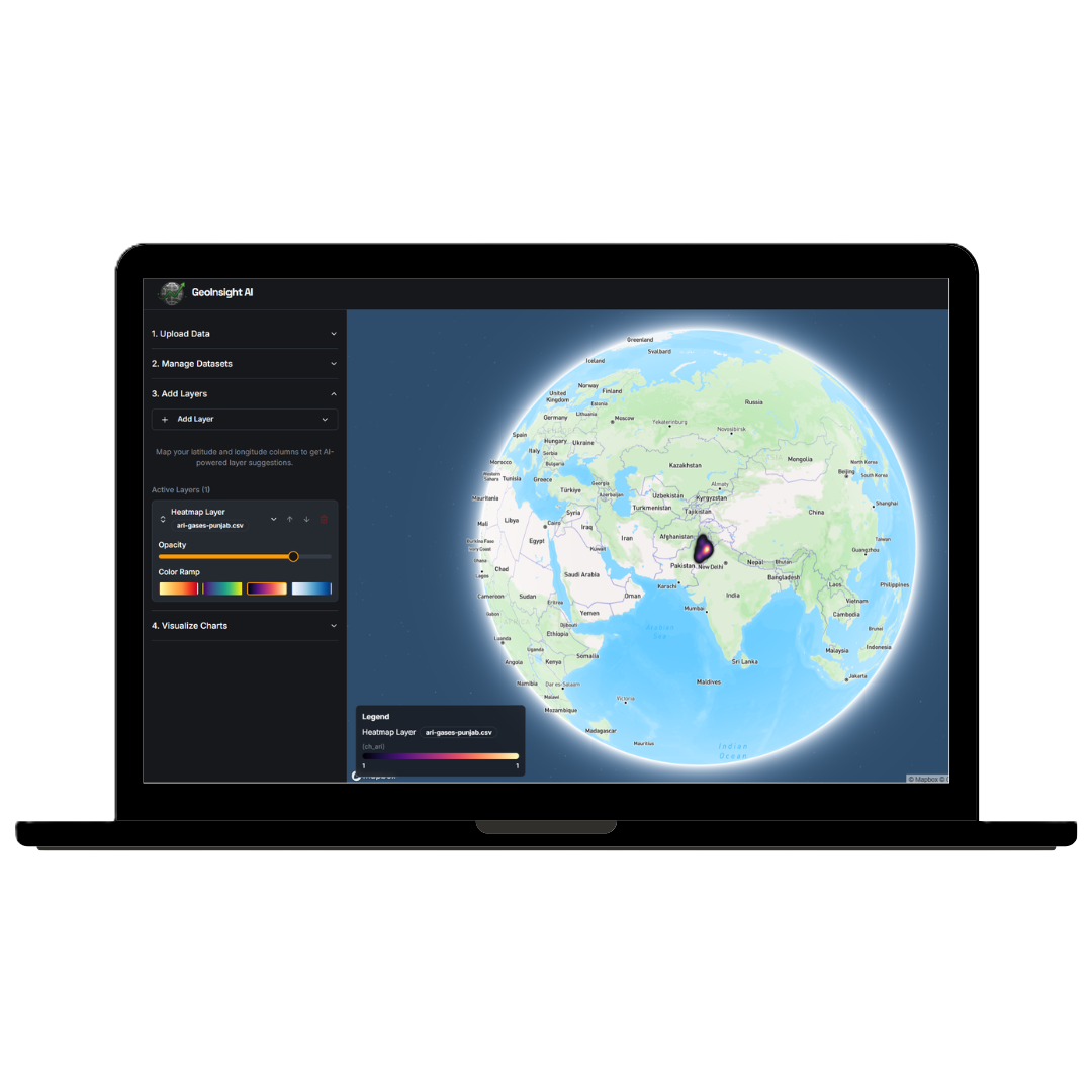
GeoInsight AI
AI-powered platform combining satellite data with health records for precision environmental intelligence.
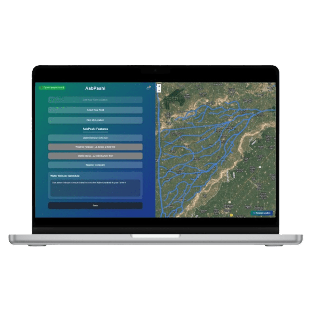
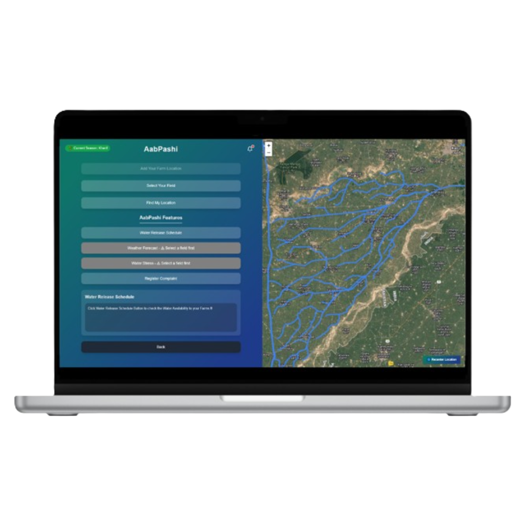
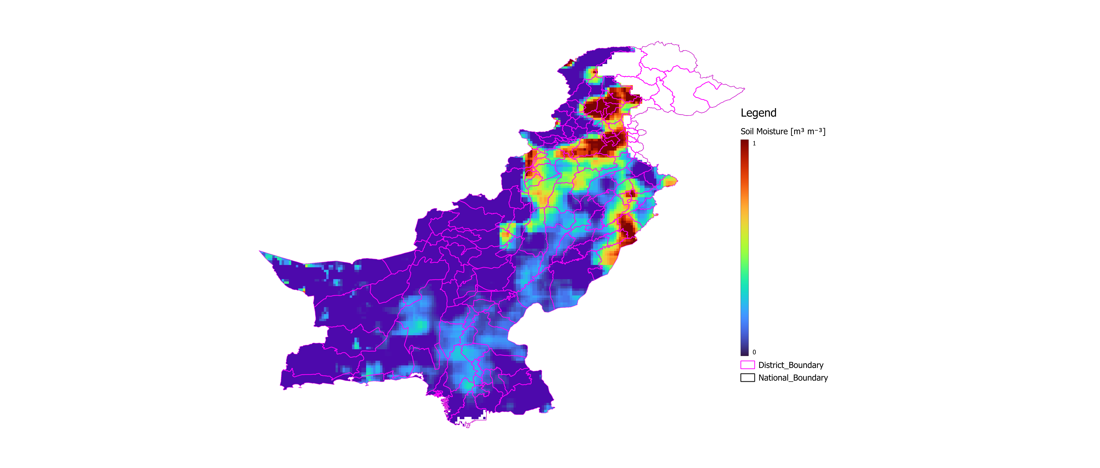
Aabpashi
Irrigation and water resource intelligence dashboard monitoring scarcity, access, and drought risk across South Asia.
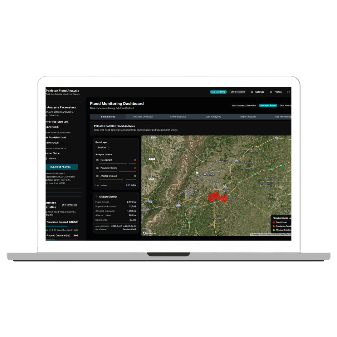
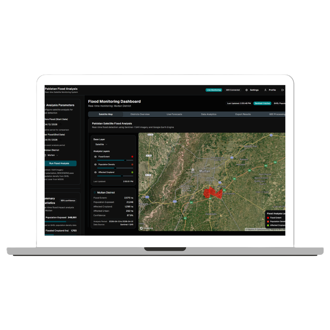
Flood Analyzer
Advanced flood risk simulation and infrastructure impact analysis. Multi-hazard forecasting at watershed scale.
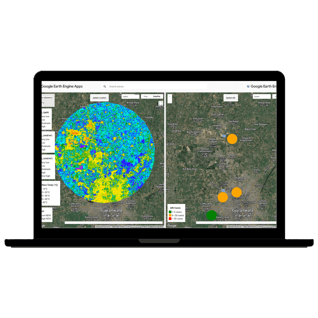
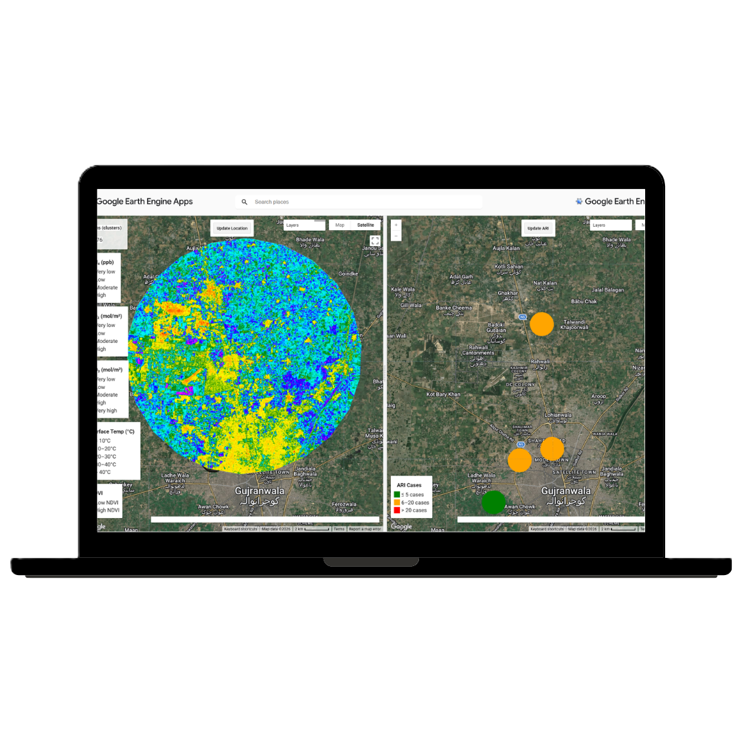
Emission × ARI
Mapping industrial emission sources against acute respiratory infections using Google Earth Engine.
Flood Lens
High-resolution flood monitoring and inundation mapping using multi-spectral satellite imagery at planetary scale.
SERVICES.
Geospatial intelligence and AI-driven monitoring services from the PHI Lab — turning Earth Observation into actionable health insights.
Illegal Kiln Activity Tracking
Carbon Footprint Tracking
Smog Detection
Flood Mapping & Health Risk Analysis
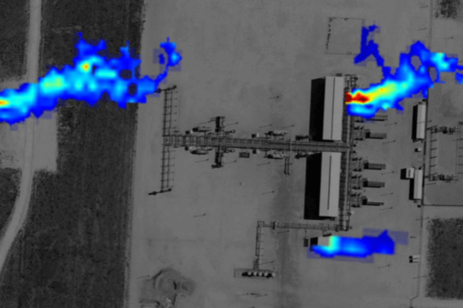
Methane Hotspots Detection
Emission Sources Detection
DATASETS.
Open and curated geospatial health datasets produced by the PHI Lab — available for research and collaboration.
ARI & Brick Kiln Exposure Dataset
Geospatial dataset linking brick kiln locations across South Asia to acute respiratory infection (ARI) incidence using satellite-derived emission indices.
Malaria Climate Risk Dataset
Multi-year dataset combining MODIS land surface temperature, precipitation, and NDVI with malaria case counts across Sub-Saharan Africa for predictive modelling.
Brick Kiln Locations Dataset
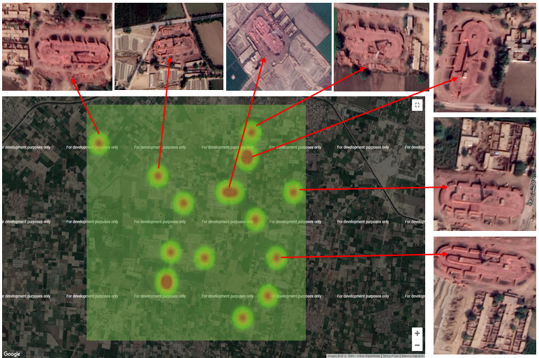
Machine-learning-derived map of >100,000 brick kilns across Pakistan, India, and Bangladesh extracted from Sentinel-2 and Google Earth Engine imagery.
Flood Inundation & Health Outcomes
Satellite-derived flood extent maps (Sentinel-1 SAR) linked to district-level morbidity records across South and South-East Asia — 2015–2023.
Heat Stress & NCD Risk Dataset
ERA5 reanalysis heat stress indices (WBGT, HI) cross-referenced with cardiovascular and diabetic emergency admissions across urban South Asian hospitals.
Dengue & Earth Observation Dataset
Merged dataset of Aedes aegypti habitat suitability (NDWI, urban heat, rainfall) with weekly dengue surveillance records across 12 countries, 2010–2024.
PUBLICATIONS.
Peer-reviewed research from the Planetary Health Informatics Lab — advancing equitable AI in global health.
Continuous Flood Nowcasting in South Asia: A Multi-Sensor Ensemble Remote Sensing Framework for Flood Extent
Usman Nazir, Disha Gomathinayagam, Muhammad Kamran, Sara Khalid · arXiv preprint arXiv:2605.10950
AlphaEarth Satellite Embeddings for Modelling Climate Sensitive Diseases Towards Global Health Resilience
Usman Nazir, I-Han Cheng, Sara Khalid · arXiv preprint arXiv:2605.10949
Evaluating large language models for clinical note processing: local fine-tuning and internal-external validation using electronic health records from South Asia
Seyed Alireza Hasheminasab, Faisal Jamil, Muhammad Usman Afzal, Ali Haider Khan, Sehrish Ilyas, Ali Noor, Awais Touseef, Salma Abbas, Hajira Nisar Cheema, Muhammad Usman Shabbir, Iqra Hameed, Maleeha Ayub, Hamayal Masood, Amina Jafar, Amir Mukhtar Khan, Muhammad Abid Nazir, Muhammad Asaad Jamil, Faisal Sultan, Sara Khalid · BMC Medical Informatics and Decision Making · Vol. 26, Issue 1 · p. 75 · BioMed Central
Evaluation of plant based indoor air purification in urban environments in Pakistan
Hafiz Muhammad Abubakar, Moeed Yusuf, Mariam Saghir, Hasnain Ahmad, Qossain Awais, Mehkaan Khan, Furqan Arshad, Zain Ali, Sara Khalid, Usman Nazir · Available at SSRN 6581360
Detecting Brick Kiln Infrastructure at Scale: Graph, Foundation, and Remote Sensing Models for Satellite Imagery Data
Usman Nazir, Xidong Chen, Hafiz Muhammad Abubakar, Hadia Abu Bakar, Raahim Arbaz, Fezan Rasool, Bin Chen, Sara Khalid · arXiv preprint arXiv:2602.13350
Genetic and Epidemiological Evidence Linking Respiratory and Musculoskeletal Diseases: Shared Risk Factors and Intervention Windows
Olivia Murrin, Bethany Voller, Ruby M Woodward, Lucía A Carrasco-Ribelles, Deniz Türkmen, Qingze Gu, Kate Boddy, Leon Farmer, Mary Mancini, Sara Khalid, Nicholas Aveyard, Chris Fox, Jack Bowden, Frank Dudbridge, Sarah E Lamb, Jane AH Masoli, Concepción Violán, Luke C Pilling, Timothy M Frayling, João Delgado · Research Square preprint
Foundation Models for Mapping Emission Sources and Acute Respiratory Infection (ARI) Hotspots
Usman Nazir, Sara Khalid · NeurIPS 2025 · Tackling Climate Change with Machine Learning Workshop
Data-Driven Prediction of Malaria Outbreaks in Nigeria
Wahab Sami, Fatima Abbas, Mohsin Sabir, Amber Razzaq, Hina Nazeer, Muhammad Abid Hayat · IEEE IGARSS 2025 — International Geoscience and Remote Sensing Symposium
Use of Machine Learning to Compare Disease Risk Scores and Propensity Scores Across Complex Confounding Scenarios: A Simulation Study
Yuchen Guo, Victoria Y Strauss, Sara Khalid, Daniel Prieto-Alhambra · Pharmacoepidemiology and Drug Safety · Vol. 34, Issue 6 · e70165 · John Wiley & Sons
Independent and combined effects of long-term air pollution exposure and genetic predisposition on COVID-19 severity: A population-based cohort study
Yudiyang Ma, Jianing Wang, Feipeng Cui, Linxi Tang, Sara Khalid, Yaohua Tian, Junqin Xie · Proceedings of the National Academy of Sciences (PNAS) · Vol. 122, Issue 10 · e2421513122
Predicting malaria outbreaks using earth observation measurements and spatiotemporal deep learning modelling: a South Asian case study from 2000 to 2017
Usman Nazir, Muhammad Talha Quddoos, Momin Uppal, Sara Khalid · The Lancet Planetary Health · Vol. 8 · p. S17 · Elsevier
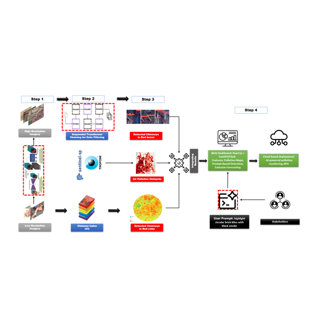
Mapping Air Pollution Sources with Sequential Transformer Chaining: A Case Study in South Asia
Usman Nazir, Hafiz Muhammad Abubakar, Raahim Arbaz, Hasnain Ahmad, Mubasher Nazir · NeurIPS · Tackling Climate Change with Machine Learning (6th)
2022 Flood Impact in Pakistan: Remote Sensing Assessment of Agricultural and Urban Damage
Hafiz Muhammad Abubakar, Arbaz Khan, Aqs Younas, Zia Tahseen, Aqeel Arshad, Murtaza Taj, Usman Nazir · Proceedings of the AAAI Symposium Series · Vol. 4, Issue 1 · pp. 405–410
Towards a spatio-temporal deep learning approach to predict malaria outbreaks using earth observation measurements in South Asia
Usman Nazir, Ahzam Ejaz, Muhammad Talha Quddoos, Momin Uppal, Sara Khalid · NeurIPS 2023 · Tackling Climate Change with Machine Learning Workshop
Machine Learning for Risk Factor Identification and Cardiovascular Mortality Prediction Among Patients with Osteoporosis
Seyed Alireza Hasheminasab, Daniel Prieto-Alhambra, Marta Pineda Moncusi, Sara Khalid · IEEE EMBC 2023 — 45th Annual International Conference of the IEEE Engineering in Medicine & Biology Society · pp. 1–4
Spatio-Temporal driven Attention Graph Neural Network with Block Adjacency matrix (STAG-NN-BA) for Remote Land-use Change Detection
Usman Nazir, Wadood Islam, Sara Khalid, Murtaza Taj · AAAI Symposium Series 2023
A standardized analytics pipeline for reliable and rapid development and validation of prediction models using observational health data
Sara Khalid, Cynthia Yang, Clair Blacketer, Talita Duarte-Salles, Sergio Fernández-Bertolín, Chungsoo Kim, Rae Woong Park, Jimyung Park, Martijn J. Schuemie, Anthony G. Sena, Marc A. Suchard, Seng Chan You, Peter R. Rijnbeek, Jenna M. Reps · Computer Methods and Programs in Biomedicine · Elsevier
Kiln-Net: A Gated Neural Network for Detection of Brick Kilns in South Asia
Usman Nazir, Usman Khalid Mian, Muhammad Usman Sohail, Murtaza Taj, Momin Uppal · IEEE Journal of Selected Topics in Applied Earth Observations and Remote Sensing (JSTARS)
Tiny-Inception-ResNet-v2: Using Deep Learning for Eliminating Bonded Labors of Brick Kilns in South Asia
Usman Nazir, Numan Khurshid, Muhammad Ahmed Bhimra, Murtaza Taj · CVPR 2019 Workshop